Lessons Learned from Lieutenant Dan
We survived the windy night and the bad tent site and dad even went as far as to say it was the best he’s slept yet out here. Not sure how that worked out. Before getting on the trail though, we added in to our morning routine the “doctoring” up of our feet. Unfortunately, the blisters have started. For dad, it was actually day 2 when he first got some, and has battling ever since. I got my first two, one each on the bottom of my second smallest toes, at the end of the day yesterday. I think it was because of the downhill and the fast pace we were walking to try and get out of the wind. It was also a rougher trail section with small jagged rocks rather than the smooth small gravel/sand path we’ve been mostly having. Whatever the reason, we strive to imitate the guidance of another one of my heroes, Lieutenant Dan, who gave two points of advice, “One, take good care of your feet. Two, try not to do anything stupid, like gettin’ yourself killed.”
After all that, we were on the trail at 6:45. It was rather chilly again, so we both opted to start with warmer clothes on this time…a good decision. After a ways, we started seeing some more incredible views looking down into Cottonwood Canyon (the canyon/valley debate rages on with no side gaining the upper hand).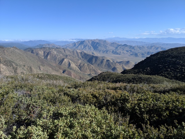 We hiked until 9:00am when we stopped at a picnic area (near Sunrise Highway) to lay out our tents to dry and eat some breakfast. We continued to try and save our feet. Rather than show photos of the nastiness, here’s the stuff we use to out on them…
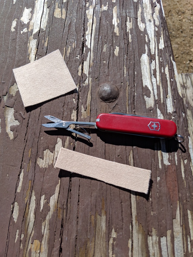
While at the picnic area we brushed up on our birding, seeming as there were several chirping away of different varieties and colors, some bright yellow and bright blue. There was a tank of water that looked a bit rough, we filled one emergency bottle from here in case we got low and needed to filter.
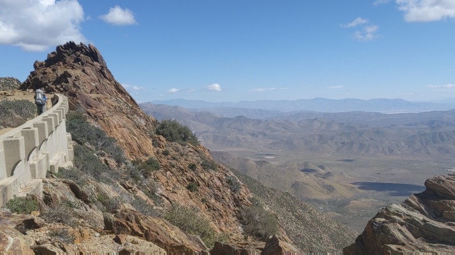
Next, we walked up a very cool section that a sign called the Pioneer Mail Trail. It was a wide flat path, cut out from a sheer rock face. Some sections had concrete retaining walls, with rather large drops off their edge…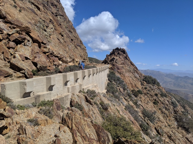
 From here we went into a neat area with large boulders placed sporadically. We found a spot for lunch on top of a large relatively flat one.
Not soon after, we began seeing ominous skies off to our left. For a while we stayed out of it, but continually we got ever closer until it finally started. We got the rain coats on and went onward. It rained lightly for an hour and a half ish.
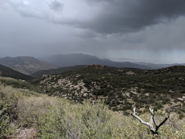

After the rain, the sun peaked out for a bit, but then clouds began rolling in again. We had a bit of a startle when both of us were looking down at the trail and heard something coming our way fast. Looking up, we saw a mile dear pouncing amongst the bushes across the trail and down out of our view. Pretty neat.Our other wildlife sitings this far have been: 4 snakes, approx. 17 rabbits, and 732 lizards of the norwegion blueback variety, the darker american boxer species (which like to do push ups on the rocks), and one unidentified fatter guy with horns.
The last mile of traffic was a steep decent like we have not seen yet. It was a rough go on the legs, feet, and knees and by the end we were happy to call it a day at 4:30pm. Somehow, we managed to do 15.6 miles today, which was more than I expected this early on! Hopefully, we don’t regret the big day, but it was mainly due to the more gradual grade of the trail today which was majority downhill.
This was our tent site for the night. We got to chat a while with a fellow backpacker named Brian from northern California before turning in. It’s been tough to figure out who you’ll see again on the trail and who’s much faster/slower, but either way we’ve enjoyed the various convos we’ve had with our fellow hikers.
Another interesting day on the trail.

I would like to submit for discussion on the topic of valleys and canyons, the presence and function (i.e. establishment of vegetation) of a floodplain. Exposed bedrock should also play a role in the determination I believe.
LikeLike
Scott…you make some good points. Discussion on this topic has been spreading amongst hikers on the trail like an invasively species. I’ve come to the conclusion that the majority of what I’ve been seeing have indeed been canyons based on the definition that they are “deeper than valleys, more narrow, and with steep sides.”. Others have submitted gorges, ravines, and arroyo’s as other contenders, however I believe they are misled.
LikeLike
Looking forward to seeing you tomorrow. I will have fresh squeezed orange juice for the H Team.
LikeLike